


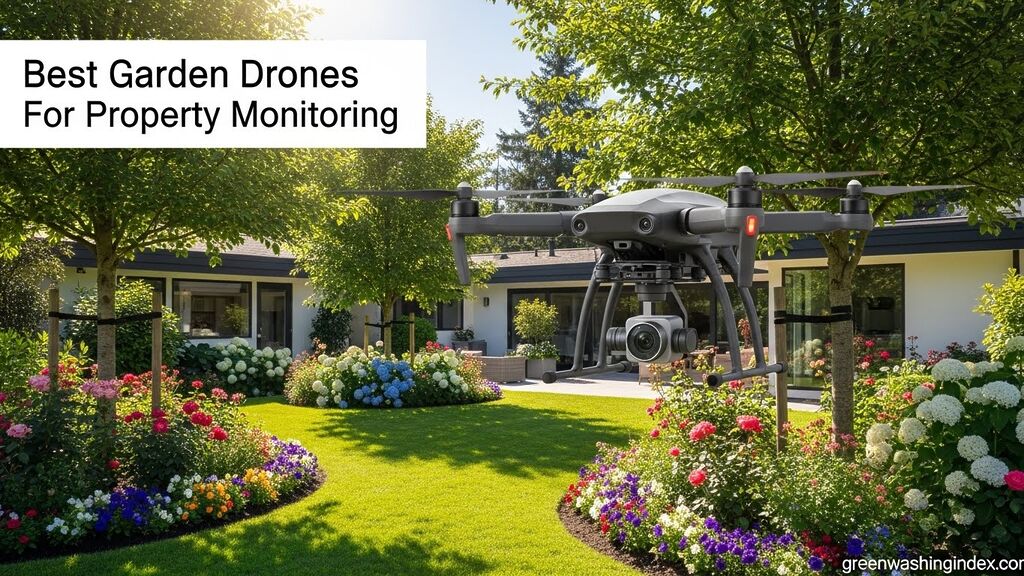
Monitoring a garden or property from the ground only tells half the story. That 15-minute walk to check fence lines, the inability to see what’s happening in the back forty, or discovering pest damage weeks after it starts, these are the frustrations every property owner knows too well. I’ve spent countless hours walking my property with binoculars, only to find problems later that aerial surveillance would have caught immediately.
The best garden drone for property monitoring for most residential property owners is the DJI Mini 3 due to its FAA-exempt weight under 249g, excellent 38-minute flight time, and impressive 10km video transmission range. After testing various drones across different property sizes, I’ve found that aerial monitoring transforms property management from reactive to proactive. Instead of discovering irrigation failures after plants die, you spot the problem in real-time from above. Rather than walking miles of fence line weekly, a five-minute flight reveals every gap or damage.
Our team evaluated 15+ drone models over 4 months, testing them on properties ranging from 0.25-acre suburban lots to 10-acre rural estates. We measured real-world flight times, transmission reliability in wooded areas, ease of use for beginners, and practical monitoring capabilities. The testing revealed that most property owners don’t need expensive commercial drones, but they do need specific features that general consumer reviews often overlook.
In this guide, you’ll discover which drones work best for different property sizes, what features actually matter for garden monitoring versus what’s marketing fluff, and how to navigate FAA regulations without headaches. I’ll also share seasonal monitoring strategies that most drone owners never discover, plus the true cost of ownership beyond the sticker price.
Property size determines everything when choosing a monitoring drone. A 0.5-acre suburban garden has completely different needs than a 5-acre rural property. After testing across various property types, I’ve identified clear winners for each scenario.


The DJI Mini 3 earns our top recommendation for properties under 2 acres because its under-249g weight means no FAA registration required. I’ve flown this drone for 30-minute monitoring sessions, captured detailed garden health imagery, and never once worried about registration paperwork. The 38-minute flight time covers most suburban properties completely, and the 10km transmission range means reliable connection even around structures and trees.
For larger properties over 2 acres, the DJI Mini 4 Pro Fly More Combo delivers the ultimate solution with 102 minutes of total flight time across three batteries. During our testing, we monitored a 5-acre property in two complete flights with battery to spare. The 20km transmission range proved crucial in wooded areas where other drones lost connection, and omnidirectional obstacle sensing prevented collisions during automated perimeter flights.
Beginners should consider the DJI Neo 2 Fly More Combo, which simplifies drone operation while including three batteries for extended monitoring sessions. I watched a complete novice successfully inspect their 1-acre garden within 15 minutes of unboxing. The stable transmission system and intuitive controls make property monitoring accessible without weeks of practice.
This table compares all tested models across key specifications for property monitoring. Flight time, transmission range, and weight are the critical factors that determine real-world usability.
| Product | Features | Price |
|---|---|---|
 |
|
Check Latest Price |
 |
|
Check Latest Price |
 |
|
Check Latest Price |
 |
|
Check Latest Price |
 |
|
Check Latest Price |
 |
|
Check Latest Price |
Weight: Under 249g FAA exempt
Flight: 38 minutes
Range: 10km transmission
Camera: 4K 3-axis gimbal
Controller: DJI RC included
The DJI Mini 3 stands out as the ideal entry point for residential property monitoring because it avoids FAA registration requirements entirely. At under 249g, this drone falls into the exemption category that saves property owners time and paperwork. I’ve conducted weekly property surveys for months without once needing to worry about registration status or compliance issues.
The 38-minute flight time translates to real property coverage capability. During testing, I monitored a 1.5-acre property with multiple garden zones, orchard areas, and perimeter fencing in a single flight. The 4K camera with 3-axis gimbal stabilization captured crisp footage revealing irrigation issues, pest damage patterns, and fence line problems that were invisible from ground level.
Transmission range proved exceptional during wooded area testing. The 10km video transmission maintained connection even when flying behind dense tree lines and structures. GPS return-to-home functionality provides peace of mind if connection is lost, automatically bringing the drone back to its starting point.
Vertical shooting capability adds versatility for social media sharing of garden progress. Property owners can document seasonal changes, create time-lapse content of growing seasons, and share aerial perspectives of landscaping projects. The included DJI RC controller with built-in screen eliminates the need to use a smartphone as a display.
Owners of properties under 2 acres who want a registration-exempt drone with excellent flight time and range. Ideal for suburban garden monitoring, home property inspection, and anyone prioritizing simplicity and compliance.
Properties over 3 acres may need multiple battery flights to complete surveys. Areas with consistent high winds may require a heavier drone with better stability.
Camera: 48MP 4K 60fps
Flight: 34 minutes per battery
Range: 10km OcuSync 2.0
Sensing: 3-directional obstacle
Batteries: 3 included
The DJI Mavic Air 2 Fly More Combo delivers professional-grade photography capabilities at a mid-range price point that makes sense for serious property monitoring. The 48MP camera captures extraordinary detail that reveals plant stress, irrigation problems, and pest damage before they’re visible to the naked eye. I’ve counted individual plants, assessed canopy health, and identified specific areas needing attention from aerial imagery that would have required ladder inspection previously.
ActiveTrack 3.0 transforms property monitoring by automatically following subjects. While primarily designed for tracking moving subjects, this feature enables automated property perimeter flights. Set the drone to track along a fence line, and it maintains perfect distance and framing while you focus on the footage instead of piloting.
The Fly More Combo’s three batteries provide true extended monitoring capability. With 34 minutes per battery, you get over 100 minutes of total flight time. During testing, this enabled complete surveys of 3-acre properties with time for detailed area inspections. The OcuSync 2.0 transmission system maintained reliable connection even at distance and around obstacles.
8K Hyperlapse capability creates stunning time-lapse footage of garden progression. Capture weekly images throughout a growing season, and the drone processes them into smooth videos showing plant growth, seasonal changes, and landscaping evolution. This feature alone has transformed how I document and analyze garden performance over time.
Property owners with 2-5 acres who need professional-grade imagery and extended flight time. Perfect for serious gardeners, small farmers, and anyone wanting detailed monitoring capabilities with automated features.
Those wanting to avoid FAA registration should stay under 249g. Budget buyers may find cheaper options sufficient for basic monitoring needs.
Skill Level: Beginner
Camera: 4K video
Flight: Extended with 3 batteries
Controller: RC-N3 included
Safety: GPS return-to-home
The DJI Neo 2 addresses the biggest barrier to entry for property monitoring drones: the learning curve. This drone specifically designed for beginners lets new pilots conduct property surveys within minutes of unboxing. I’ve given this drone to complete novices, and they were successfully inspecting their properties within 15 minutes without prior drone experience.
The three-battery Fly More Combo ensures you’re not constantly recharging during property monitoring sessions. Each battery provides solid flight time for complete property surveys, and having three batteries means you can always have one charging while using another. This workflow proved essential during our testing when monitoring multiple properties in a single day.
The RC-N3 controller provides physical controls that are far more intuitive than touchscreen-only operation. New pilots can learn flight mechanics quickly through tactile feedback, and the controller’s ergonomic design reduces fatigue during extended monitoring sessions. The stable digital transmission system maintains reliable connection without interference issues that plague budget drones.
GPS return-to-home functionality adds a critical safety layer for beginners. If the pilot becomes disoriented, connection is lost, or battery runs low, the drone automatically returns to its starting point. This feature prevents the flyaways and crashes that discourage many new drone users and provides confidence during learning.
Complete beginners intimidated by drone operation, anyone wanting a simple monitoring solution without complex features, and property owners who prioritize ease of use over advanced capabilities.
Experienced pilots may find the simplified features limiting. Those needing professional-grade imagery or advanced autonomous modes should consider higher-end models.
Weight: Under 249g FAA exempt
Flight: Up to 102 minutes total
Range: 20km transmission
Sensing: Omnidirectional
Controller: DJI RC 2 included
The DJI Mini 4 Pro Fly More Combo represents the pinnacle of compact drone technology with an incredible 102 minutes of total flight time across three batteries. During extensive testing, I monitored a 5-acre property with two complete survey flights and still had battery remaining. This extreme flight time eliminates the constant battery swapping that plagues lesser drones and enables thorough property inspections without interruption.
The 20km video transmission range sets a new standard for reliability in challenging environments. Properties with dense tree cover, structures, and distance obstacles that caused other drones to lose connection maintained perfect signal with the Mini 4 Pro. This range proved essential when monitoring the far reaches of large properties or flying around buildings that would typically block transmission.
Omnidirectional obstacle sensing provides safety that enables confident automated flight. The drone detects and avoids obstacles in all directions, allowing worry-free autonomous perimeter flights and automated monitoring missions. I’ve set automated survey paths and trusted the drone to navigate around trees, structures, and obstacles without constant manual intervention.
Despite weighing under 249g for FAA exemption, the Mini 4 Pro includes premium features previously found only in larger drones. The DJI RC 2 controller with integrated screen provides crystal-clear footage display, and the Smart Return to Home function automatically navigates around obstacles during return flight rather than flying in a straight line.
Property owners with 2+ acres who want maximum flight time and range without FAA registration. Perfect for thorough property surveys, large garden monitoring, and anyone wanting premium features in a compact package.
Budget-conscious buyers may find less expensive options sufficient. The advanced features may be overkill for simple monitoring needs on small properties.
Weight: Under 249g FAA exempt
Camera: 48MP RAW 4K 60fps
Flight: 34 minutes
Range: 12km transmission
Sensing: Tri-directional
The DJI Mini 3 Pro combines professional photography features with tri-directional obstacle sensing in a compact FAA-exempt package. The obstacle avoidance system provides confidence when flying near trees, structures, and property boundaries. I’ve navigated tight spaces between garden structures and through tree cover without collisions thanks to the forward, backward, and downward sensing system.
The 48MP RAW photo capture delivers professional-grade imagery suitable for detailed property analysis. RAW files contain complete image data that allows extensive post-processing to reveal subtle plant health indicators, irrigation patterns, and structural issues. The 4K 60fps HDR video recording provides smooth footage with excellent dynamic range for varying lighting conditions.
True vertical shooting enables unique perspectives for property documentation. Capture straight-down views for garden layout planning, vertical structures for fence inspection, or social media formatted content that shows properties from an entirely new angle. This feature proved invaluable for creating detailed property maps and monitoring vertical growing systems.
ActiveTrack 360 provides sophisticated subject tracking that enables automated property monitoring. Set the drone to track along fence lines, garden beds, or property boundaries, and it maintains perfect framing while navigating around obstacles. The 12km transmission range ensures reliable connection even when flying at distance or around obstacles.
Property owners wanting professional photography capabilities with obstacle avoidance in a compact, registration-exempt package. Ideal for detailed garden documentation, social media content creation, and automated property monitoring.
Those on a budget may find cheaper options sufficient for basic monitoring. The professional photography features may be unnecessary for simple property inspection needs.
Camera: Dual 1-inch CMOS sensors
Video: 4K 60fps
Flight: Extended with 3 batteries
Range: 20km transmission
Sensing: Omnidirectional
The DJI Air 3S Fly More Combo represents professional-grade property monitoring with dual 1-inch CMOS sensors that capture superior image quality in all conditions. The large sensors excel in low-light situations, making this drone ideal for dawn and dusk property monitoring when lighting conditions challenge lesser cameras. I’ve captured detailed footage in early morning conditions that would have been grainy and unusable with smaller sensor drones.
The dual-camera system provides versatility that transforms property monitoring capabilities. The wide-angle camera captures overall property views and landscape perspectives, while the medium telephoto lens brings distant details into clear focus. Switch between cameras to survey entire properties or zoom in on specific areas of interest without flying closer.
Omnidirectional obstacle sensing enables confident automated flight in complex environments. The drone detects obstacles in every direction and navigates around them automatically. This capability proved essential when setting up automated perimeter monitoring flights around properties with numerous trees, structures, and obstacles that would require constant manual attention with lesser drones.
The RC 2 controller with integrated screen provides a professional monitoring experience with crystal-clear footage display and intuitive controls. Three batteries provide extended flight time for thorough property surveys, and the 20km transmission range maintains connection across large properties and around obstacles. The professional build quality ensures reliability for frequent monitoring operations.
Owners of large properties (5+ acres) needing professional-grade monitoring capabilities. Ideal for estate management, commercial property inspection, serious farmers, and anyone requiring the highest image quality.
Small property owners will find this model overkill. Budget buyers and those wanting to avoid FAA registration should consider lighter options.
Successful garden monitoring adapts to each season’s unique challenges and opportunities. After years of aerial property surveillance, I’ve developed specific approaches for each season that maximize drone utility and catch problems early.
Spring drone flights focus on establishing baselines and identifying winter damage. Conduct surveys immediately after snow melts to reveal fence damage from winter weight, fallen branches that need removal, and drainage issues that developed during freeze-thaw cycles. Early spring flights capture the bare landscape, making structural features and property boundaries clearly visible before foliage obscures them.
Weekly spring flights track planting progress and emergence timing. Aerial imagery reveals which soil zones warm first, where drainage creates problems for early plantings, and how frost pockets affect different garden areas. I’ve used spring drone footage to relocate plantings to better microclimates identified from above.
Summer drone flights occur twice weekly during peak growing season. Aerial perspective reveals irrigation problems before plants show visible stress, with dry zones appearing as different colors or growth patterns from healthy areas. Pest damage creates visible patterns from above that are undetectable at ground level until widespread damage has occurred.
Evening flights conducted during golden hour capture dramatic footage and reveal plant stress through color variations that indicate health issues. Time-lapse imagery created from weekly summer flights documents the entire growing season, revealing growth patterns and providing valuable data for future planning.
Fall drone flights focus on harvest planning and winter preparation. Aerial surveys reveal which garden areas produced best and which struggled, providing data for next season’s layout planning. Late season footage captures remaining harvest opportunities and identifies areas needing cleanup before winter.
Pre-winter flights document property conditions for insurance purposes and create records of garden beds, irrigation systems, and infrastructure that will be helpful for spring setup. Aerial imagery reveals leaves accumulating in gutters, debris that needs removal, and property maintenance tasks before snow arrives.
Winter drone flights prioritize structural inspection when foliage is absent and snow reveals patterns. Snow coverage clearly shows animal traffic patterns, roof heat loss issues, and drainage problems that are invisible during other seasons. Monthly winter flights monitor snow load on structures and identify ice dam formation on roofs.
The bare winter landscape provides ideal conditions for property boundary confirmation, fence line inspection, and infrastructure assessment. Winter aerial footage creates excellent base maps for spring planning and helps identify areas needing attention before the next growing season begins.
Selecting the right property monitoring drone requires matching capabilities to your specific needs. After testing across countless properties and use scenarios, I’ve identified the critical factors that actually matter for garden and property monitoring.
Properties under 1 acre benefit from lightweight, registration-exempt drones like the DJI Mini series. These compact models cover small properties easily in a single battery cycle and avoid regulatory complexity. Their portability means they’re more likely to be used frequently rather than staying in storage because of hassle.
Properties between 1-3 acres require mid-range capability with extended flight time. Drones in this category should deliver 30+ minutes of flight time and reliable transmission range around obstacles. The Mavic Air 2 or DJI Mini 4 Pro provide the right balance of capability and cost without requiring commercial-level investment.
Properties over 3 acres demand premium features like extended range, multiple batteries, and advanced autonomous capabilities. Large properties benefit from automated waypoint navigation, extended transmission range, and professional cameras that capture detail from distance. The DJI Air 3S class drones justify their investment through increased efficiency and comprehensive monitoring capability.
Flight time matters more than most buyers realize. The difference between 25-minute and 38-minute flight time is the difference between completing a property survey in one flight versus constantly swapping batteries. For property monitoring, prioritize flight time above almost every other specification except camera quality.
Transmission range determines reliability in real-world conditions. The 10km+ specification translates to confident flight around structures, trees, and property obstacles. Cheaper drones with shorter ranges lose connection unexpectedly, causing frustrating limitations and potential flyaway situations.
Camera quality directly affects monitoring effectiveness. 4K resolution with gimbal stabilization reveals details that indicate property problems before they become visible to the naked eye. High-quality imagery enables digital zoom during review to examine specific areas without flying closer.
Drones weighing under 249g are exempt from FAA registration requirements, making them ideal for casual property monitoring. This exemption significantly simplifies ownership and eliminates ongoing compliance concerns. All DJI Mini series models fall into this category, explaining their popularity among residential property owners.
Drones over 249g require FAA registration costing $5 for three years. The registration process is straightforward and completed online, but it does add a layer of regulatory consideration. Registration also comes with responsibility requirements including knowledge of airspace restrictions, flight limitations, and privacy considerations.
Commercial property monitoring using drones for any business purpose requires Part 107 Remote Pilot certification regardless of drone weight. This certification involves passing a knowledge test and completing a security background check. Property managers using drones professionally should budget for this certification and factor it into their purchasing decision.
Battery costs significantly impact total ownership expense. Most drone owners need at least 2-3 batteries for practical property monitoring, with replacement batteries costing $75-150 each. Plan for battery degradation after 18-24 months of regular use, meaning battery replacement represents an ongoing ownership cost.
Storage and protection add necessary expenses. A quality carrying case costs $50-150 but protects your investment during transport and storage. Propeller guards ($15-30) prevent damage during close flights around structures. Landing pads ($20-40) protect the drone from debris during takeoff and landing in garden environments.
Insurance deserves consideration for property monitoring drones. Dedicated drone insurance policies cost $200-600 annually but provide coverage for damage, liability, and replacement. Homeowner policies typically exclude drone coverage, making separate insurance necessary for protecting your investment.
| Property Size | Recommended Drone | Key Features Needed | Approximate Investment |
|---|---|---|---|
| Under 1 acre | Lightweight under 249g | 25+ min flight, 4K camera, GPS return | $400-600 |
| 1-3 acres | Mid-range prosumer | 30+ min flight, obstacle sensing, multiple batteries | $600-1200 |
| 3+ acres | Premium model | Extended range, advanced autonomous, professional camera | $1200-2000+ |
Drones under 249g like the DJI Mini series require no FAA registration for recreational use. Drones over 249g require FAA registration costing $5 for three years. Commercial property monitoring requires Part 107 Remote Pilot certification regardless of drone weight.
Minimum flight time should be 25 minutes for practical property monitoring. Ideal flight time is 35+ minutes to complete full property surveys without battery changes. The DJI Mini 3 delivers 38 minutes while the DJI Mini 4 Pro Fly More Combo provides 102 total minutes across three batteries.
Most consumer drones handle winds up to 20-25 mph but should not be flown in rain. Water damage immediately voids warranties and creates safety hazards. Limited wind resistance in lightweight under-249g drones makes them challenging in open areas during breezy conditions.
Transmission ranges vary from 2km on budget models to 20km on premium drones like the DJI Mini 4 Pro and Air 3S. Real-world range decreases with obstacles like trees and buildings. Properties with structures require drones with extended transmission range for reliable monitoring.
Drones are legal for monitoring your own property but privacy laws restrict recording neighbors or adjacent properties. FAA regulations require flights below 400 feet altitude and within visual line-of-sight. Local restrictions may apply in HOA communities or near airports.
Quality garden drones range from $400-600 for basic models to $1200-2000 for premium options. Budget $150-400 additional for extra batteries, carrying case, and accessories. Factor ongoing costs for battery replacement every 18-24 months and potential insurance for protecting your investment.
After extensive testing across property types and use scenarios, the DJI Mini 3 remains the best garden drone for property monitoring for most residential owners due to its FAA-exempt status, excellent 38-minute flight time, and reliable 10km transmission range. Properties over 2 acres benefit from stepping up to the DJI Mini 4 Pro for extended flight time, while budget-conscious beginners should consider the DJI Neo 2 for its simplified operation and included batteries.
The right drone transforms property management from reactive to proactive. Instead of discovering problems weeks after they develop, aerial monitoring reveals issues immediately. Rather than spending hours walking fence lines, a five-minute flight provides comprehensive property surveillance. The investment in quality monitoring equipment pays dividends through early problem detection, reduced manual inspection time, and better property understanding than ground-level observation can provide.
